• 1
Find a Viewpoint
Machico is an excellent choice for anyone looking for beautiful scenery and a harmonious connection between the surrounding landscape and the built heritage of the Island.

It is difficult to find somewhere without an amazing view, especially during outdoor activities at higher altitudes.

Each parish has its must see viewpoints that showcase the amazing and unique views. Most of these points have breath-taking views of the Atlantic Ocean in the background.

Find some of the best viewpoints in Machico and share the natural viewpoints you have discovered along your journey by sending your favourite photos to VisitMachico®.

Viewpoints

Baía D'Abra

Viewpoints

Quinta do Lorde

Viewpoints

Ponta do Rosto

Viewpoints

Nossa Senhora da Piedade

Viewpoints

Prainha

Viewpoints

Caniçal

Viewpoints

Pico do Facho

Viewpoints

Senhor dos Milagres

Viewpoints

Francisco Álvares de Nóbrega

Viewpoints

Queimada

Viewpoints

Ingleses

Viewpoints

Portela

Viewpoints

Gambão

Viewpoints

Fortim do Pico

Viewpoints

Porto da Cruz

Viewpoints

Penha de Águia

Panoramic spots

Baía D'Abra

Panoramic spots

Ponta do Rosto

Panoramic spots

Ponta do Bode

Panoramic spots

Casas Próximas

Panoramic spots

Penha de Águia

Panoramic spots

Cabeço da Ribeira Seca

Panoramic spots

Pico Cancela

Panoramic spots

Pico Castanho

Panoramic spots

Boca do Risco

Panoramic spots

Pico Furado

Panoramic spots

Queimada

Panoramic spots

Pico das Macelas

Panoramic spots

Fajã dos Rolos

Panoramic spots

Pico do Suna

Panoramic spots

Lamaceiros

Panoramic spots

Portela

Panoramic spots

Boqueirão

Viewpoint
Baía da Abra

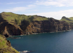
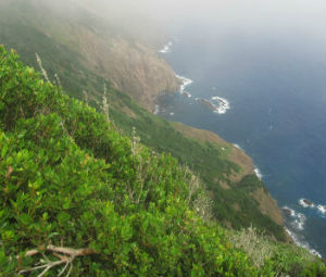
Baía d'Abra is a picturesque cove located between Ponta da Abra, and Ponta do Furado in the São Lourenço peninsula. Ponta de São Lourenço is one of the most unique places in Madeira. Its arid landscape, devoid of trees reveals another facet of the Island. Thus, the Baia d'Abra viewpoint offers one of the most spectacular views of Ponta de São Lourenço, making it possible to observe every corner of the peninsula.

Parish: Caniçal

Coordinates:32°44′35.20″N,16°42′02.73″W

Slide background

Baía D'Abra

VisitMachico

Viewpoint
Nossa Senhora da Piedade Chapel

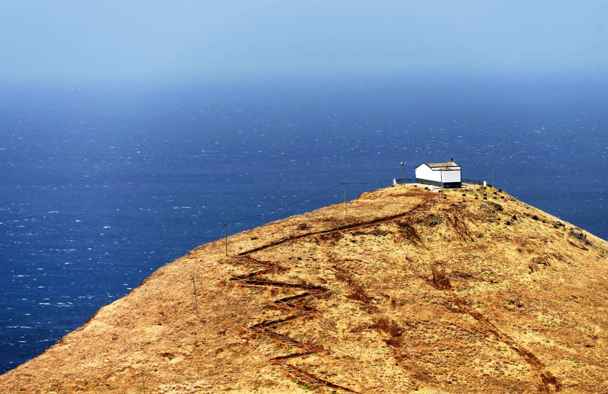
The little chapel is located on top of Monte Gordo, an extinct volcano that rises literally from the depths of the surrounding sea. Located at 114 meters of altitude, this viewpoint offers a wide view of the surrounding area, highlighting Quinta do Lorde, Prainha and Desertas Islands.

The sky-blue chapel is at the centre of one of the most unique processions on the Island. Legend has it that a group of fishermen ran into trouble out at sea, promising to build a chapel in honour of the saint if they were saved. Miraculously, the fishermen got back to dry land, fulfilling their promise by building the chapel. Today, the celebration takes place on the third weekend of September and attracts people from all over the Island.

To reach the viewpoint, it is necessary to climb short path that leads to the top of the hill. It is wise to wear suitable footwear.

Parish: Caniçal

Coordinates:32°44′33.58″N,16°42′47.87″W

Slide background

Capela de N. Sra. da Piedade

VisitMachico

Slide background

Miradouro da Capela de N. Sra. da Piedade

VisitMachico

Slide background

Miradouro da Capela de N. Sra. da Piedade

VisitMachico

Viewpoint
Ponta do Rosto (Marconi)

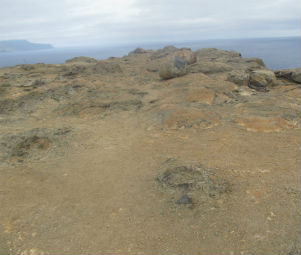
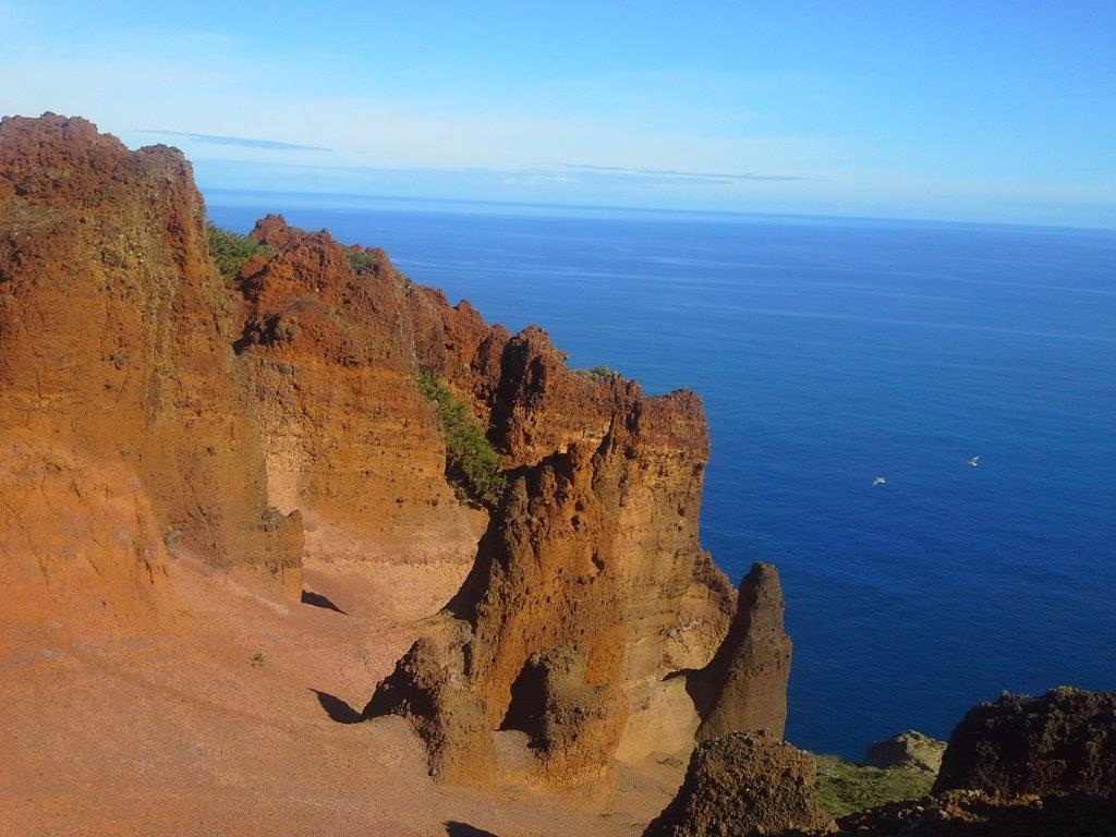
The Ponta do Rosto viewpoint is in the Northern part of the peninsula and offers magnificent views of the East coast of Madeira . Named after a rock formation that resembles a face, the viewpoint is a geosite and a great place to observe the local geology. On clear days, it is possible to see Porto Santo on the horizon.

Parish: Caniçal

Coordinates:32°44′59.52″N,16°42′27.34″W

Slide background

Ponta do Rosto (Marconi)

VisitMachico

Slide background

Miradouro da Ponta do Rosto (Marconi)

VisitMachico

Slide background

Miradouro da Ponta do Rosto (Marconi)

VisitMachico

Viewpoint
Portela

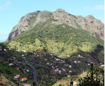
Machico is a land of diverse landscapes and the Portela viewpoint, at 670 metres altitude, is one of the best examples. Surrounded by pretty Hydrangeas that complement the rural landscape, the views of Porto da Cruz are breath-taking. The natural beauty of the village with its rustic houses scattered around the valley complete the scene. The conspicuous Penha de Águia is a natural landmark that acts as a division between two municipalities.

Parish: Santo António da Serra

Coordinates:32°44′51.16″N,16°49′31.12″W
Slide background

Portela

VisitMachico

Slide background

Miradouro da Portela

VisitMachico

Viewpoint
Prainha

Situated below Nossa Senhora da Piedade viewpoint, Miradouro da Prainha is located on the cliff overlooking the beach below. It is a pleasant place to observe the small natural sand cove and Monte Gordo (or da Piedade) an extinct volcano that rises from the sea. There are benches and picnic tables at the viewpoint, allowing visitors to comfortably enjoy the surrounding landscapes.

Parish: Caniçal

Coordinates:32°44′32.67″N,16°43′00.44″W

Slide background

Prainha

VisitMachico

Viewpoint
Queimada

Miradouro da Queimada, located near Miradouro de Francisco Alvares de Nóbrega, offers breath-taking views over the vast valley. The discreet viewpoint is perfect for those who want a moment alone. Besides Machico, the airport and São Lourenço peninsula are both highlights of this viewpoint.

Parish: Border Machico-Água de Pena

Coordinates:32°42′55.24″N,16°46′22.16″W

Slide background

Queimada

VisitMachico

Viewpoint
Quinta do Lorde

The Quinta do Lorde viewpoint, located just to the right on the road between the resort and Baía d'Abra has wonderful views of the South-Eastern coast of Madeira, namely Caniçal, Machico and Santa Cruz.

Parish: Caniçal

Coordinates: 32°44'23.96"N,16°42'13.18"W

Slide background

Quinta do Lorde

VisitMachico

Slide background

Miradouro da Quinta do Lorde

VisitMachico

Slide background

Miradouro da Quinta do Lorde

VisitMachico

Viewpoint
Caniçal

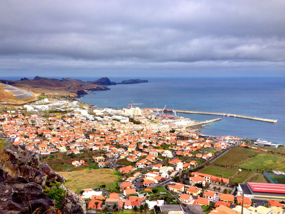
The Caniçal viewpoint, located along the road down to the village is an excellent stopping point where you can observe the fishing village. From the Madeira international business centre to the São Lourenço peninsula, this viewpoint offers a different perspective of the South-East.

Parish: Caniçal

Coordinates: 32°44'20.01"N,16°44'50.75"W

Slide background

Caniçal

VisitMachico

Slide background

Miradouro do Caniçal

VisitMachico

Viewpoint
Gambão

Located on Estrada Regional 108 between Portela and Porto da Cruz, the Gambão viewpoint has wonderful views of the parish. A must-see for anyone venturing along the meandering regional roads, the main attraction is the majestic Penha de Águia.

Parish: Porto da Cruz

Coordinates: 32°45'0.40"N,16°50'5.87"W

Slide background

Gambão

VisitMachico

Viewpoint
Pico do Facho

Positioned between Machico and Caniçal, the Pico do Facho viewpoint stands at 330 metres tall. The name, meaning Peak of the Torch, comes from its historical importance. A torch, located on the peak would be lit, warning the population of eminent danger. With views of Santa Cruz, Machico and Caniçal this viewpoint is a must-see for those exploring the South-Eastern coast. On clear days you can even see Porto Santo on the horizon towards the Northeast. The torch no longer exists. However, there is a small fireplace, tables and benches that allow you to enjoy the views while you sip on a cool drink or eat a traditional espetada.

Parish: Machico

Coordinates:32°43′25.98″N,16°45′31.34″W

Slide background

Pico do Facho

VisitMachico

Slide background

Miradouro Pico do Facho

VisitMachico

Slide background

Miradouro Pico do Facho

VisitMachico

Viewpoint
Porto da Cruz

The Porto da Cruz viewpoint is located just above Alagoa Beach, yet the views from this small viewpoint extend from the village to the Northern shores of Ponta de São Lourenço. A place worth visiting, where the ballad of the sea soothes the soul and the dance of the surfers that dominate the waves awakens the heart.

Parish: Porto da Cruz

Coordinates:32°46'29.22"N,16°49'48.82"W

Slide background

Porto da Cruz

VisitMachico

Slide background

Miradouro Porto da Cruz

VisitMachico

Slide background

Miradouro Porto da Cruz

VisitMachico

Viewpoints
Senhor dos Milagres

Senhor dos Milagres is strongly linked to the parish of Machico and connected with one of the greatest natural disasters to happen there. The legend goes that in 1803 a great flood devastated the parish, destroying the chapel where the image of Senhor dos Milagres was. The image was swept out to sea. It was miraculously found three days later and delivered to the Cathedral in Funchal. Ten years later, after the reconstruction of the chapel, the statue was returned.

The viewpoint is located 60 metres above sea level, on the Eastern side of the valley. From there you have privileged views of the parish, from the sea to the surrounding mountains.

Parish: Machico

Coordinates:32°43'15.15"N,16°45'44.43"W

Slide background

Senhor dos Milagres

VisitMachico

Slide background

Miradouro Senhor dos Milagres

VisitMachico

Viewpoint
Fortim do Pico

Besides being a beautiful viewpoint, Fortim do Pico is a historical building. The small outpost, built in 1708 was an important lookout that guarded the North coast. However, less than 100 years later, in 1804 it was dismantled. Today, only the walls and views remain. With Ponta de São Lourenço and the Funduras mountains to the East, Penha de Águia to the West, Porto da Cruz to the South and the Atlantic Ocean to the North this viewpoint is a must! On clear days, you can see Porto Santo on the horizon.

Parish: Porto da Cruz

Coordinates:32°46'28.63"N,16°49'37.69"W

Slide background

Fortim do Pico

VisitMachico

Slide background

Miradouro do Fortim do Pico

VisitMachico

Slide background

Miradouro do Fortim do Pico

VisitMachico

Viewpoint
Francisco Álvares de Nóbrega

The Francisco Alvares Nóbrega viewpoint has one of the best views of Machico. Situated in Água de Pena, the viewpoint sits on the Western slope of the valley. Machico appears in the background as the earthy tones of the terracotta roof tiles and surrounding vegetation stand out. The surrounding mountains that adorn the parish give Machico a sheltered feel. Besides Machico, you can watch the beautiful bay composed of two beaches (pebble and sand) and Ponta de São Lourenço.

Known as "Camões Pequeno", Alvares de Nóbrega was a Machico native. The poet, persecuted by the Inquisition, was born on Rua dos Moinhos in 1772 and died in 1806 at 33 years old.

Parish: Água de Pena

Coordinates:32°42′46.95″N,16°45′53.22″W

Slide background

Francisco Alvares de Nóbrega

VisitMachico

Slide background

Miradouro Francisco Alvares de Nóbrega

VisitMachico

Viewpoint
Ingleses

Miradouro dos Ingleses, located at Quinta da Junta in Santo António da Serra is a scenic viewpoint hidden among the lush vegetation of the garden. The Quinta once belonged to the Blandy family of English origin. From the colonial style of the building to the picturesque garden planted with luxuriant endemic and exotic vegetation, the British influence is evident, hence the name: Miradouro dos Ingleses. The property was later sold to the General Board of the District of Funchal (Junta Geral), becoming known as Quinta da Junta.
The viewpoint, surrounded by a grove of trees overlooks the Northern part of the Machico Valley and São Lourenço peninsula. The pleasant benches invite you to enjoy a snack or simply relax in the company of the small birds that chirp there.

Parish: Santo António da Serra

Coordinates: 32°43'39.51"N,16°48'59.09"W

Slide background

Ingleses

VisitMachico

Slide background

Miradouro dos Ingleses

VisitMachico

Viewpoints
Estreito

Parish: Caniçal

Coordinates:32°44'46.93"N,16°41'14.32"W

Slide background

Estreito

VisitMachico

Viewpoints
Pedra Furada

Parish: Caniçal

Coordinates:32°44'55.22"N,16°41′50.88"W

Slide background

Pedra furada

VisitMachico

Viewpoints
Cabo de Larano

Parish: Porto da Cruz

Coordinates:32°45'41.07"N,16°48′18.77"W

Slide background

Cabo do Larano

VisitMachico

Viewpoints
Vila

Parish: Porto da Cruz

Coordinates:32°46'20.63"N,16°49′40.63"W

Slide background

Vila

VisitMachico